A long time ago, I remember challenging a friend to name the capital of all
the prefectures of Japan, which turned out to be easier than I had thought.
I'd ask the prefecture and they'd have to respond with the capital. Although
my friend failed the challenge, what I didn't realize was that the majority of
Japanese prefectures have the same name as their prefectural capitals. This is
very much unlike American states.
More recently, I asked myself: What's the story behind the prefectural capital
usually being same as the prefecture name? And what were the reasons a city
would be picked as a capital? What is the story behind the founding of the
prefectures?
For the second question, I assumed the main reasons would be something like
the following:
Largest city in the prefecture at the time of founding
Central location in the prefecture - For ease of transportation
Historical "importance"
I spent the last few months searching the web for an answer to those three
questions, mostly using Japanese language sources. I didn't read any books
cover to cover, though that might have helped. This post is a summary of the
information I dug up. I tried my best to use "official" sources, but sometimes
the reasons are mostly speculation. I will use the Western calendar as the
system is just way easier to understand. The ordering of the prefectures will
be by the Japanese governmental order which is approximately North to South.
The date I chose is when the prefecture got most of its modern form. I will
generally ignore offshore islands. Small changes could have occurred after the
given date.
The population source I generally use is the first
共武政表 survey from 1875 (vol
1,
2). This survey was done by
the army and is available in digitized form. Wikipedia also has a nice
summary
of other data sources from that era.
But first, some general background information about the creation of Japanese
prefectures. This is probably not needed if you're well versed in Japanese
history, though it would have helped me before starting this research.
Background
The current prefectures of Japan came about around the time of the
Meiji Restoration. Many of them correspond almost entirely to one or more old
令制国
(Provinces) set up in the Nara era (710-794), which remained unchained
throughout until the Meiji Restoration (1868). However, throughout the
Tokugawa Shogunate, the actual subdivisions in use was the 藩 (han/domain).
Domains were controlled by a feudal overlords or 大名 (daimyo). All daimyos
were nominally under the suzerainty of the Tokugawa Shogun, who also had a
number of places under direct control such as Tokyo (Edo) and Osaka. Domains
were replaced with prefectures with the
廃藩置県 (abolish domains and establish
prefectures) movement in 1871.
The military capabilities of each of these daimyos was approximated via
石高 (kokudaka). One 石高
was supposed to be enough to feed one person for one year and non-rice items
were converted into rice units for the purposes of the calcuation. The largest
assessed value for one of the daimyos was 加賀藩, based in modern day Kanazawa, at over 1 million. Furthemore, because the
assessed values were not updated frequently, many domains had effective 石高
that was much higher than the nominal amount (長州, modern day 山口, had an assessed
369k vs 978k effective)
Lastly, a small bit about the Meiji restoration itself. The restoration is
often said to be brought about by the 4 southwestern provinces of 薩長土肥
(薩摩 modern day Kagoshima,
長州 modern day 山口,
土佐 modern day Kouchi, and
肥前 modern day Saga). Of these 4, 薩長土
were the original anti-shogun instigators and 肥前 was added later. The
anti-shogun forces fought in civil war called the
戊辰戦争 (Boshin war). The most opposition
came from Northern Japan, who formed the so called Northern Alliance. As the
eventual victors in the power struggle, the southwestern provinces also took
over the majority of the governmental positions after the Restoration.
One thing they did with that governmental power was to create the prefectures
of Japan. This is the so called
賞罰的県名説
(Theory that Prefectural Names are a Reward/Punishment). There are a few
variations of the theory, but they effectively claim that the names of the
prefectures were picked as a reward/punishment for the events of the
Restoration/Boshin War. In particular, it splits the domains/prefectures into
忠勤藩 (loyal domains),
曖昧藩/日和見藩 (unclear domains/opportunistic
domains), and 朝敵藩 (domains that were
the enemies of the court aka enemies of the Meiji Revolution). One claim of
this theory is that non-loyal domains were supposedly not allowed to use their
prefectural capital city name as the prefectural name. Furthermore, the
capitals of many non-loyal domains were not allowed to be prefectural
capitals. This theory has a number of issues and is certainly an
oversimplification. For example, many of prefectural names were returned to
the prefectural capital names like 富山 and there were many cases were the
capitals of non-loyal domains were allowed to be prefectural capitals for many
years like 若松県, which lasted 7 years. Despite these flaws, the theory has
some merit so we'll mention this theory in some discussions, especially when
the information is limited.
Hokkaido - 北海道 (1886)
北海道 was formed from the merger of 根室県, 札幌県, 函館県 in 1886. The capital was Sapporo
as it is centrally located and was home to the previous Hokkaido Development
Commission.
The Hokkaido Development Commission (開拓使庁) was established in 1869 in
Tokyo. The buildings moved to 函館 in 1870 and then to 札幌 in
1871. In 1882, the Hokkaido Development Commission was absolished and the
island was split into 根室県, 札幌県, and 函館県, which were combined in
1886 to form Hokkaido.
札幌 only had a population of
1785. Even though Hakodate (pop
28825) was much bigger and the central focus of development on Hokkaido up until
then, the reason for the move from Hakodate to Sapporo may have been that
Hakodate was too far to the south of the
island.
Sapporo was chosen as the spot in central Hokkaido for development for reasons
such as the following:
札幌の辺りぞ大府を置くの地なるべし…此の札幌に府を置玉はば、石狩は不日にして大坂の繁盛を得べく...津石狩は伏見に等しき地となり
(Sapporo is the place where the government offices should be placed. If
the government offices are placed here in Sapporo, Ishikari will soon be
as prosperous as Osaka and Tsuishikari will be equal to Fushimi.)
青森県 was formed from the merger of 弘前県, 黒石県, 斗南県, 七戸県, 八戸県, and 館県 on September 4th, 1871 as 弘前県
and capital at 弘前. But by
September 23rd 1871, Aomori was picked as the capital and the prefecture was renamed to
Aomori. One major stated reason is that Aomori is centrally located in the
province.
新編弘前市史 通史編4(近・現代1) ページ6
(New Edition of Hirosaki City History - Historical Overview 4 pg. 6)
The picking of 青森 as the capital is odd because 青森 (pop
10780) was a much smaller city than 弘前 (pop
33052). Furthermore, Hirosaki Domain had even been rewarded 10k石高 for their
efforts in the Boshin war so it was unlikely to be a punishment against
enemies of the court. According to the
Hirosaki City History, Hirosaki was considered a loyal domain as the prefectural name was
originally Hirosaki.
The reason for the change was likely due to the proposal of
野田
豁通. The
stated
reason was that Hirosaki was not centrally located after the merger of so
many prefectures. Additionally, the use of Hirosaki's castle town would make
it hard to break old feudalistic traditions. Meanwhile, Aomori was 「陸羽第一ノ大港ニテ海運得便、陸奥渡島両国ヲ管轄スルニ最上ノ要地」(The best port in Rikuu[modern day Touhoku] and
thus convenient for sea transport. It is the best place to command Mutsu
[Aomori Prefecture] and Oshima [Southern Hokkaido]). Another
unstated reason
was perhaps to avoid the large number of samurai in Hirosaki. The people of
Hirosaki did not
aggressively oppose
the move of governmental buildings to Aomori, probably because they saw it
as prudent to not oppose the new Meiji government. There had been an
incident in 1871 that ended in the imprisonment of
山田登, which may have also dissuaded opposition.
Iwate - 岩手県 (1876)
Iwate was formed in 1870 with 盛岡藩 as
its base. Its original name was 盛岡県, but it got its name changed in 1872.
It gained its modern form in 1876 after getting
二戸 from Aomori, the northern parts of the
disbanded 磐井県, and some northern parts of 宮城県.
盛岡藩 was a major member of the Northern Alliance and because of that the
ruling 南部 clan was demoted to lordship of
白石 (Modern southern Miyagi) in 1869. But
after agreeing to pay
~7 billion yen based on the 1両=1万円 estimate from BoJ700k両
as punishment, 南部 was able to return to 盛岡. That however came with a
reduction of 石高 from
200k
to
130k. Due to this excessive debt, the domain came close to economic collapse.
To avoid that, the Nanbu clan abolished its own domain and gave it to the
Meiji government in 1870, before the rest of the country in 1871. The new
prefectural name in 1871 came from the district (岩手郡) that Morioka was
in. According to an announcement by the 太政官,
当盛岡県ノ名、元盛岡藩因襲ノ呼称ニテ...兎角藩治ノ風習脱却仕兼候間、今般新県御改立ノ折抦、旧名ヲ改メ、岩手県ト相唱申度
(The name of Morioka Prefecture is a name from the antiquated Morioka
Domain... At any rate, it is difficult to break free of the old
tranditions from being ruled by a domain. So, with the creation of a new
prefecture, we request to change the old name and be called Iwate
Prefecture)
At least outwardly, the name change was supposedly a request from Morioka
Domain. However, the truth is uncertain.
盛岡 was the largest city by far in the area with a population of
25457. It was also the historical capital of the large 盛岡藩 so it was natural
to pick as the capital. Morioka is also centrally located in the prefecture.
Miyagi - 宮城県 (1876)
Miyagi was formed in 1871 with 仙台藩 as
its base. Its original name was 仙台県, but it got its name changed in 1872.
It gained its modern form in 1876 after getting the southern parts of the
disbanded 磐井県 and some adjustments with
岩手県.
仙台藩 was one of the leaders of the Northern Alliance and suffered a major
reduction in 石高 from 620k to
280k. It took the name 宮城 from the district (宮城郡) where 仙台 was located.
Just like with Iwate there are no
real records
indicating why the name was changed.
仙台 was largest city in the region by far with a population of
51998. It was also the historical capital of the huge 仙台藩 so it was natural
to pick as the capital. Sendai is also centrally located in the prefecture.
Akita - 秋田県 (1872)
Akita was formed in 1871 with 秋田藩 as its base. 秋田藩 was originally
known as 久保田藩, but its lords requested a name change to 秋田. A number of surrounding
small prefectures (岩崎, 亀田, 本荘・矢島), にかほ area, and 鹿角 were
merged in 1872
to give Akita it's modern form.
Although Kubota was part of the Northern Alliance, they joined the Meiji
side very early on 久保田藩 in the Boshin War. Since all their neighbors
were enemies, they got invaded and suffered during the war. Before the
abolishment of domains, the Kubota lords sent a request to change their name
to Akita:
秋田が我が藩では最も古い名前だから由緒ある名前に戻したい、
久保田をやめて秋田に戻したいといってお願いをしているんです (Akita is the
oldest name for our domain so we want to return to using a name with
history behind it. We are requesting to stop using Kubota and return to
using Akita.)
秋田県の秋田の由来は? - NHK
(What is the origin of the Akita in Akita Prefecture)
That request was accepted. With that the domain became Akita Domain and name
of the castle town of Kubota was changed to Akita.
秋田 was the largest city in the region by far with a population of
33142. It was also the historical capital of the large 久保田藩 so it was
natural to pick as the capital.
Yamagata - 山形県 (1876)
Yamagata was formed in 1876 with the merger of the original 山形県,
置賜県, and 鶴岡県.
The entire area had been members of the Northern Alliance and had fought
against the Meiji government forces. In particular,
庄内藩 (based in 鶴岡) may have
triggered
the Boshin War due to ordering the
burning
the Satsuma domain buildings (薩摩藩邸焼き討ち事件) as reprisal for Satsuma
samurai causing havoc in Tokyo and burning Shounai buildings. After the
defeat of the Tokugawa forces at the Battle of Toba-Fushimi, domains in
Northern Japan were ordered to take care of
会津 and 庄内. The Nothern domains generally
refused as they thought the treatment of Aizu and Shounai was unfair and
formed the Nothern Alliance. 米沢藩 (aka
置賜) was one of the two leaders of the Northern Alliance along with 仙台.
Thus, 庄内 and 米沢 were seen as particularly anti-Meiji and were punished
accordingly in 石高 after the war (庄内:
170k → 120k
[it's said that the punishment was lightened because of a
~3 billion yen based on the 1両=1万円 estimate from BoJ300k両
payment from the Honma clan of Sakata], 米沢:
180k → 140k). Yamagata's lord on the other hand had been in Kyoto at the start of the
war and were not allowed to return to their domain. In the interim, their
retainer had
joined
the Northern Alliance. Because the lords had not joined the alliance
directly, Yamagata did not suffer a loss in 石高.
The choice of Yamagata as capital was quite odd. It was only 3rd in
population in 羽前国 at
17683. It was only half the size of 米沢 (pop
34911). 鶴岡 (pop
24092) was also quite a bit larger. The following is speculation, but some
reasons it may have been chosen are:
Yamagata is centrally located
米沢 and 庄内 were seen as particular anti-Meiji and as punishment they
were not allowed to be the capital (however, they were capitals of 置賜県
and 鶴岡県 so this is somewhat suspect)
It was historically an important city in the early Warring States/Early
Tokugawa period
Fukushima - 福島県 (1876)
Fukushima was formed in 1876 with the merger of the second version of
福島県,
若松県, and the majority of 磐前県.
The enitre area had fought against the Meiji forces in the Boshin War in the
Nothern Alliance. 会津藩 was particularly
hated by the 長州 forces. This was because the lord of Aizu had heavily
suppressed
長州 activities as Military Commissioner of Kyoto (京都守護職); Aizu had
also been a major force in the Battle of Toba-Fushimi. As described in the
section on 山形, the ordering of other Northern domains to take care of Aizu
led to the formation of the Northern Alliance. Aizu fought bitterly against
the Meiji forces. After their surrender, their lord was forced from 会津藩
and its 230k石高 to a 30k石高 domain in Northern Aomori (斗南藩). Some
17k
Aizu Samurai joined their lord in this exile. Many died.
Fukushima, inconveniently located on the northern edge of the prefecture, is
an interesting choice for capital. Nowadays, it's the only prefecture where
the capital is the 3rd largest city in the prefecture. But, maybe in the
Meiji era, it was a much more notable city... Alas even in the early Meiji
period, Fukushima (pop
6013) was nowhere close to being the largest city in the combined
岩代国 and
磐城国. 若松, the largest city in the prefecture, had over 3 times the population
at
20588. To be fair, Wakamatsu is also inconveniently located and was capital of
会津藩. It may have been rejected as being related to 会津藩, but it was a
prefectural capital for many years beforehand so that explanation is not
entirely convincing.
A convenient location for Fukushima prefecture's capital would have to be in
the central 1/3 of the prefecture (中通り). Some other cities of similar
size to Fukushima at the time in the central area were
白河 (pop
7391) in the far south and 二本松 (5467), the most centrally located. One reason Shirakawa may have not been
chosen was because its lord 阿部正外 had opened Kobe to foreigners. This was
heavily opposed
by 大久保利通 (Okubo Toshimichi), a major Satsuma statesmen (credit to this
great blog for the
links). Nihonmatsu may have been excluded because it had fought
hard
against the Meiji forces, refusing to surrender the castle in order to not
betray the Northern Alliance. Meanwhile Fukushima had
surrendered
without fighting.
The reason for Fukushima as the capital are in the end
unclear
and without much basis. Some stated reasons in 「福島県史」are: To make it
inconvenient to the people of Aizu, to remove the remnants of the anti-Meiji
domains, Kooriyama was not big and had never historically been a capital,
and Fukushima was a market town [note: as opposed to a samurai town] and
close to Sendai's government functions.
The ideal choice of a prefectural capital would be in central Fukushima like
modern day 郡山. However, at that time, Kooriyama was a small town in the middle of a dry
plain. With the development of the Asaka Canal (安積疏水) in the early Meiji period, the area started to become prosperous.
That canal involved 850k people, including many former samurai without work,
and cost 1/3 of the yearly civil engineering budget of Japan. It has been
been recognized by
Japan Heritage
(English version). Since then, there have been a number of movements to move the capital to
Kooriyama. The earliest was in 1885, but there are still
efforts
in modern times.
Ibaraki - 茨城県 (1875)
茨城県 was formed in 1875 with the merger of the first version of 茨城, the
parts of 新治県 north of the (利根) Tone
River, and parts of 千葉県 north of the Tone
River.
水戸 was the head of the Mito Domain, which was
one of the three domains ruled by Tokugawa family members (Gosanke/御三家).
Historically, they were one of the few families allowed to provide a Shogun
if needed. During the late Tokugawa era, Mito was famous for 水戸学 (Mito
School of Thought). The Mito School of Thought was very influential in the
尊皇攘夷 (Respect the Emperor and Expell the Barbarians) movement that
motivated many in the Satsuma and Choushuu domains to start the Meiji
Revolution. Mito samurai had also rebelled against the Tokugawa government
in the 天狗党の乱 (Tengutou Rebellion).
In 1871, Mito Prefecture was combined with a number of smaller prefectures
in 常陸国 to form Ibaraki Prefecture.
Ibaraki took its name from the district (茨城) where Mito was located.
According to
research
by Mito City Middle Schoolers, this name change might have been because Mito
had not contributed enough to the Meiji government. Movements to change the
name back continued until 1877. In 1875 the rest of parts Hitachi Province
and parts of
下総国 were merged in from Niihari
Prefecture and Chiba Prefecture. The old path of the 利根 river formed the
border, but the route of the river has changed so the border no longer
follows the river.
水戸 (pop
19177) was the largest city in the prefecture. It was also the historical
capital of the large 水戸藩 so it was natural to pick as the capital. The
second largest city was 土浦 (pop
7788). Mito is also centrally located in the prefecture.
Tochigi - 栃木県 (1876)
The majority of 栃木 came into being in 1873 with the merger of 栃木県 and
宇都宮県. In 1876, the parts in the west that belonged to
上野国 were given to Gunma.
Modern day Tochigi is nearly equivalent to the
下野国 (Shimotsuke Province). However,
the first Tochigi Prefecture formed in 1871 only contained the western part
of Shimotsuke Province. It also contained a sizeable part of Kouzuke Provice
that now is part of Gunma. When it merged with Utsunomiya Prefecture in
1873, Tochigi became the prefectural capital. In terms of the sizes of the
cities, this was an odd decision as Utsunomiya (pop
15061) was much larger than Tochigi (pop
3968). This was even though much of Utsunomiya had burned down in the Boshin
War.
According to
research done by a student
at Utsunomiya University, because Utsunomiya Prefecture only had the
equivalent of a prefectural vice-governor (権参事) appointed, it was being
prepared for merger even when it was first founded. According to that same
research,
鍋島貞幹, the first governor of Tochigi Prefecture, had been operating under the
idea of 一国一県 (One Province = One Prefecture) from even before the
formation of the first Tochigi Prefecture and had used the Shimotsuke
Province symbols previously. However, starting in 1882, a movement to move
the capital to Utsunomiya began. The movement failed in 1882, but with the
appointment of the civil engineering project loving
三島通庸 as governor in 1883, the movement gained
momentum. They succeeded in 1884.
The
main argument
was that Tochigi was too far south in the prefecture now that the Kouzuke
Province areas had been moved to Gunma. Utsunomiya, being centrally located
in the prefecture, would be
easily accessible. It was also more connected to Nothern Japan and to Tokyo via land routes.
The Touhoku Main Line railroad also would go through Utsunomiya but not
Tochigi. The Utsunomiya faction had dedicated supporters in 5 of Tochigi
Prefecture's 9 districts while Tochigi City only had 2 districts as
supporters. The biggest argument against moving was the cost of moving and
the sunk cost of having newly built prefectural buildings in Tochigi.
However, one major counterpoint and factor in the success of the movement
was that Utsunomiya citizens were willing to pay for the move themselves:
県庁移転ノ費用ハ悉皆有志人民ニ於テ負担スベシ (The cost of moving the
prefectural capital will be borne by volunteering citizens.)
The zeal of the Utsunomiya citizens for the move was tangible in the
willingness to pay. Oddly enough the name of the prefecture was not changed.
someone forgot to inform some local officials though as they proclaimed it
Utsunomiya Prefecture. It was corrected not
6 days later.
Wikipedia has a
great article
on the move of the capital.
Gunma - 群馬県 (1876)
The majority of 群馬 came into being in 1871 with the merger of many smaller
prefectures. It merged with 入間県 to form
熊谷県 in 1873. But, in 1876, it split off
again and gained some of the western districts of Tochigi.
Modern day Gunma is nearly equivalent to the
上野国 (Kouzuke Province). There was a
文書館どより 第6号. pg 5proposal
by 青山貞 originally to call Gunma, 上野県 (Kouzuke
Prefecture), but that was not taken up. It was also actually called 高崎圏
(Takasaki Prefecture) for around 1 week before a proclamation changed the
name to Gunma Prefecture stating「高崎県ノ儀云々ノ情実モ有之候」(As for
Takasaki Prefecture, there are many circumstances...) as the reason. The
name 群馬 came from the district that conveniently both Takasaki and
Maebashi are in.
The capital was picked as Takasaki originally for somewhat unclear reasons.
Maebashi was bigger population wise (15063
vs
11285), bigger 石高-wise historically, and the castle had been recently
reconstructed via
donations from residents
in 1867. This
文書館どより 第6号. pg 5source
speculates that it was because Takasaki had better transportation links as a
station on the Nakasendo road. Takasaki is still better connected as it is
on a Shinkansen route.
The merger with Iruma Prefecture into Kumagaya Prefecture occurred because
because
the two prefectures shared the same governor (河瀬秀治). When Gunma was reformed in 1876, the capital was again in Takasaki.
There were some issues with the Takasaki prefectural offices such as there
was no space due to the Army taking up the area around the castle and the
general lack of space for public officials to live. Maebashi offered some
facilities for free usage. The petition by the governor was accepted in late
1876. In December 1876, the so called Maebashi 25 (前橋二十五人衆)
donated
a total of
~265million yen based on the 1両=1万円 estimate from BoJ26.5k両
for construction. An additional 4000両 was donated for a school building and
other public buildings. The donors were primarily in the silk industry,
which was thriving in Maebashi. According to the governor in 1877, the move
to Maebashi was
supposed
to be temporary while the government was dealing with tax reform, but the
prefectural capital was officially moved to Maebashi in 1881. Over 1000
Takasaki residents who went to Maebashi to protest. It went as far as a
lawsuit, but in 1883, the Tokyo appeals court
decided
against Takasaki.
Saitama - 埼玉県 (1876)
Saitama was formed from the merger of the original 埼玉県 and the parts of
熊谷県 that had belonged to
入間県.
The original prefectural capital when the first version of Saitama was
formed in 1871 was at 岩槻. It was moved "temporarily" to 浦和 after
about 1 month. It would stay in Urawa indefinitely. As Urawa was a station
on the Nakasendo, it would be easier to get to Tokyo. According to
松本博之, the
real reason
for the move was written in the Tokyo Nichi Nichi Shimbun (東京日日新聞,
nowadays the Mainichi Shimbun) by a former Iwatsuki Mayor in 1935. The
reason was because former samurai very skilled in martial arts in Iwatsuki
were not hired by the government. As a result, the former samurai would
brandish their weapons and harass the government offices.
Nowadays both Iwatsuki and Urawa are part of Saitama city, but it was an odd
choice to put the capital there after the merger of the former Iruma
Prefecture. At the time the main cities that formed the modern Saitama City
were small (大宮: pop
1978, 浦和: pop
1602, 与野: pop
1280, 岩槻: pop
3921). In contrast, 川越 (pop
9276) the capital of Iruma Prefecture was much more developed and
熊谷 (pop
4053), the capital of Kumagaya prefecture was also bigger. Furthermore, by
being on the southeastern edge of the prefecture, the modern Saitama City
area was
very inconvenient
for the people of the Kumagaya area. Kawagoe was formerly ruled by the
Matsudaia (a subfamily of Tokugawa) may have been a consideration and
Kumagaya was also inconveniently on the northern edge. Regardless, the fact
that the capital remained in Urawa instead being moved to a more central
location
shows
that proximity to Tokyo was more important than convenience to the people of
the prefecture.
The name Saitama comes from the district that Iwatsuki belonged to. It was
not changed to 足立 even though Urawa was part
of that district. That might be because of the "temporary" nature of the
move.
Chiba - 千葉県 (1875)
Chiba was formed from the merger of
木更津県
印旛県 in 1873. In 1875, Chiba gained the
parts of the dissolved 新治県 south of the
(利根) Tone River. In conjunction, they gave Ibaraki the districts north of
the Tone River; some districts were also given to Saitama.
In 1873, Kisarazu Prefecture and Inba Prefecture both had
柴原和 as governor. They were merged and the town
of Chiba,
directly
on the north/south border, was chosen as prefectural capital.
Chiba was a small place at that point with population
3110. For comparison, 船橋 (pop
8117), 佐倉 (pop
6681), and 木更津 (pop
4395) were all bigger. There were many other similar or larger sized places.
The choices of the Meiji era have a huge impact as Chiba City is huge with
nearly 1 million in population nowadays. The other cities are much smaller.
With the dissolution of Niihari Prefecture, the large city of
銚子 (pop
19857) became part of Chiba. One wonders that if Niihari had been merged at the
beginning, the capital would have been chosen somewhere in the middle of all
three prefectures. According to
this blog post, that would have been near Sakura. However, the merger to form Chiba was
likely because of the shared prefectural governor so this counterfactual
probably would never have happened.
Tokyo - 東京都 (1893)
Tokyo was renamed from Edo in 1868 and gained most of modern form in 1893
with the merger of the
三多摩 area (Three Tama Areas).
Tokyo was the largest city in Japan with population
830917, but originally only was did not contain even all 23 modern wards. The
Tama area had been split into 4 parts (north, south, east, west) in 1878.
Tokyo got the East Tama area (modern day Nakano/Suginami) and Kanagawa got
the other 3 (the so-called 三多摩).
Kanagawa was first formed as prefecture in 1868 to manage Yokohama. In 1871,
it absorbed the nearby domains and gained the Tama area. In 1876 it absorbed
the 相模国 parts of
足柄県. In 1893, it gave up the Tama areas to Tokyo.
Kanagawa covers all of 相模国 (Sagami
Province) and part of 武蔵国 (Musashi
Province). The start begins with the opening of Japan with the Perry
Expedition and the ensuing Harris Treaty (日米修好通商条約) in 1858. One of
the provisions of the treaties was the opening of the port of "Kanagawa."
Yokohama (at the mouth of the 大岡 River, the
center of which is
near
the
高札場) at that time was a undeveloped beach area around
安政の開港、平成の邂逅. pg 2. (Ansei Era Port Opening, Heisei Era
Encounter)4km away
from the Kanagawa station (at the mouth of the
帷子 River,
安政の開港、平成の邂逅. pg 3. (Ansei Era Port Opening, Heisei Era
Encounter)near
modern day Yamashita Park) on the Tokaido road. However, it was chosen
instead of Kanagawa station to be the port opened to foreigners. One reason
was:
東海道からは野毛山と海に隔てられている離れ島のような横浜の地形は、ちょうど長崎の出島のように、外国人を日本人と分離するのに都合がよい
(Yokohama has geography like a remote island as it is separated from the
Tokaido by Nogeyama and the Ocean. It will let us conveniently separate
foreigners and Japanese people just like in Dejima Island in Nagasaki.)
井伊
直弼 - quoted in 安政の開港、平成の邂逅.
pg 3. (Ansei Era Port Opening, Heisei Era Encounter)
America was not pleased with this development as they had
安政の開港、平成の邂逅. pg 3. (Ansei Era Port Opening, Heisei Era
Encounter)compromised already
by agreeing to Kanagawa station; they had originally wanted Edo (Tokyo) or
Shinagawa as one of the open ports. The Tokugawa Shogunate made the claim
that Yokohama was part of Kanagawa. The Shogunate spent lots of effort to
build Yokohama and also at the same time, they banned entertainment like
prostitutes in Kanagawa to entice foreigners to go to Yokohama. This made
Yokohama flourish and Kanagawa station slowly decline. Kanagawa station is
now part of Yokohama.
By the early Meiji period, Yokohama (pop
63064) was one of the largest cities in Japan. Kanagawa the namesake of the
prefecture was much smaller (pop
8890). Kanagawa initially asked for control of the Tama area as by the Harris
Treaty foreigners were allowed to go (外国人遊歩規定 included up to 六郷川 —
part of the Tama river) to parts of Tama area. They were given up
voluntarily in 1893 to form the current shape of Kanagawa. For more
information, see the Tokyo section.
The merger of Ashigara Prefecture brought in the rest of Sagami Province,
including the large city of Odawara (pop
12639). Odawara had been historically important before the Tokugawa era as the
home of the later Hojo clan. The prefectural capital was not changed with
this merger. The reason may have been that Yokohama was much larger and
related to the treaties.
Niigata - 新潟県 (1873)
Niigata was formed from the merger of the first 新潟県 and
柏崎県 in 1873.
相川県 (Sado island) was merged in in
1876.
Niigata covers the entirety of the
越後国 as well as
佐渡国. Niigata (pop
32043) city was originally under the control of
長岡藩. However, in 1836 and in 1840, the Tokugawa Shogunate
exposed
illegal smuggling of Chinese goods in Niigata city. To prevent the illegal
smugging, the Shogunate took direct control over the port in 1843. Niigata
was eventually opened to foreigners in the Harris Treaty (日米修好通商条約)
as it was the largest port city on the Sea of Japan coast and under the
direct control of the Shogunate.
Niigata city is a bit north in the prefecture. A more convenient position
may have been
長岡 (pop
15882), a major castle town. However, Nagaoka Domain had fought fiercely against
the Shogunate forces in the Boshin War
fending
off a force of ~20k Meiji solders for months with ~5000 soldiers at 北越戦争
(Battle of Hokuetsu). Because of the heavy military expenditure in the
Boshin War and the
huge
reduction in 石高 from 75k to 24k, the domain had heavy debts. Many people
in the domain struggled for basic necessities like food. Even so, the
leadership worked to found a new school. There was a famous incident 「米百俵」 (One Hundred Bags of Rice) where a neighboring domain gave 100 bags of
rice to help feed the local population, but the leadership refused to
distribute any. In a dramatized retelling, they claimed:
この百俵は、今でこそただの百俵だが、後年には一万俵になるか、百万俵になるか、はかりしれないものがある
(These 100 bags are only 100 bags right now. But in the future, they could
become 10k bags or 1 million bags)
However, the reality may have been that the Nagaoka Domain leadership wanted
to
美談「米百俵」の誕生とその真実. pg 23. (The birth and truth of the tale
of the 「100 bags of rice」)prove
to the Meiji government that they were committed to the ideals of the new
government. The 100 bags of rice would only be a
美談「米百俵」の誕生とその真実. pg 24. (The birth and truth of the tale
of the 「100 bags of rice」)small
part of the money needed to open a new school anyway. Indeed, the domain
government didn't get any support from the Meiji government and overextended
itself financially. Only a few months after the opening of the new school,
in 1870, the domain governor gave up his governorship. That made Nagaoka
Domain part of Kashiwazaki Prefecture. This was before the rest of the
country had abolished domains.
The fact that it had fought so fiercely against the Meiji government in the
Boshin war and the fact that it lost of governmental functions before the
abolishing of domains likely prevented Nagaoka from becoming a prefectural
capital. It definitely has a better location in terms of transportation
links.
高田 (pop
25163) was far in the south in modern day 上越. Takada had directly fought against the forces of Nagaoka in the Boshin
War and was historically the location of the Echigo Province government
offices. However, it was still part of Kashiwazaki Prefecture and wasn't a
capital so evidently it wasn't even in consideration. Other large cities
included 柏崎 (pop
7746), and 新発田 (pop
8919).
Toyama - 富山県 (1883)
Toyama was first formed in 1871 and renamed to
新川県 later the same year. After gaining
the rest of the land in 越中国 (Etchuu
Province), it was merged into 石川県 in
1876. Toyama become independent again in 1883.
Toyama Prefecture covers the entirety of the old
越中国 (Etchuu Province). During the
Tokugawa Era, it was controlled by a subsidiary domain of the 1 million 石高
加賀藩 (the largest in Japan after the Shogun)
based in modern day Ishikawa Prefecture's 金沢. Toyama city (pop
44682) was one of the biggest cities in Japan and the biggest city in 越中 by
far. 高岡 (pop
23724) was another large city.
Niikawa (Toyama) Prefecture and the northern part of modern Fukui Prefecture
(嶺北) was merged into Ishikawa in 1876 to form the so called 大石川県 (Big
Ishikawa Prefecture). According to
福井県史
(History of Fukui Prefecture), the main reasons were to reduce the
expenditures by prefectures by consolidating and strengthen central control
by reducing the reliance on former samurai in old domains. However, Ishikawa
prefecture was already a very difficult prefecture to govern with numerous
samurai. Merging in Toyama and Fukui only made it more challenging.
There were some interesting reasons why Toyama was broken up. First, there
was the movement by the people of Toyama. As part of Ishikawa, they found
that their interests were frequently opposed:
加・能人の急務とする道路の開鑿は、越中人に何の利益もなく、越中人の必要とする堤防の築造は加・能人これを無用とし
(The excavation of roads that the people of Kaga and Noto [modern
Ishikawa] find pressing have no benefit to the people of Etchuu. The
construction of levees that the people of Etchuu need are useless to the
people of Kaga and Noto.)
石川県史 第4編
(The History of Ishikawa Prefecture - Volume 4).
The conflicts over the budget came to a
ふるさと富山 百三十年のあゆみ. pg 5. (Our Hometown Toyama - 130 year of
history)climax
during the era of governmental fiscal contraction (松方デフレ - Matsukata
Deflation) following the Satsuma rebellion. Governmental support for flood
control stopped and the conflicts with the rest of Ishikawa prefecture came
to a head; the prefectural assembly (県会) was even dissolved.
Another potential factor in the splitting up of Ishikawa Prefecture was to
ふるさと富山 百三十年のあゆみ. pg 5 コラム. (Our Hometown Toyama - 130
year of history)weaken
the power of Ishikawa Prefecture. In particular, the head of the Home
Ministry (内務卿), 大久保利通, was murdered by disgruntled samura from Ishikawa in the Kiozaka Incident
(紀尾井坂の変). That marked Ishikawa as a difficult to govern prefecture. A
new tax on medicine in 1882 may have been to generate revenue for the
splitting of the prefecture. The alignment of both citizen and central
government interests was very fortuitous.
Thisbloghas
a great series on the breakup of Ishikawa Prefecture.
Ishikawa - 石川県 (1883)
Ishikawa was first formed as Kanazawa Domain in 1869. It then became
Kanazawa Prefecture in 1871. In 1872, the capital temporarily moved to
美川 and got the name Ishikawa. In 1876, it
absorbed modern Toyama and northern Fukui Prefectures. In 1881, Fukui became
independent while Toyama became independent again in 1883.
Ishikawa Prefecture covers
加賀国 and
能登国. Kanazawa (pop
109685) was the 5th largest city in Japan (after Tokyo, Osaka, Kyoto, Nagoya) and
the biggest city in Kaga and Noto Provinces by far. It was home base of the
1 million 石高 加賀藩 (the largest in Japan
after the Shogun).
Although Kaga Domain controlled Kaga, Noto, and part of Etchuu Provinces,
Kanazawa prefecture only contained Kaga Province. In 1872, the governor
petitioned to move the capital to 美川, farther to the south. The petition
also advocated to change the name to Mikawa Prefecture. The stated
石川県成立の歴史的考察. pg 7. (Historical Inquiry of Ishikawa
Prefecture Founding)reasons
were:
With only Kaga province under control, Kanazawa was too far to the north.
Mikawa was more central.
Because of the abolishment of hereditary allowances (家禄) to samurais, work for them would result in them leaving Kanazawa and
the inevitable decline of Kanazawa.
Poor residents of Kanazwa petitioning the government would be a problem
The petition was accepted by the central government, but the name was
changed to Ishikawa. One possible reason for the name change is that Kaga
Domain was a unclear domain (曖昧藩) and the central government found it a
convenient opportunity to change the name without upsetting the samurai of
Kanazawa too much. Apparently, there were
石川県成立の歴史的考察. pg 9. (Historical Inquiry of Ishikawa
Prefecture Founding)reports
that after the announcement of the move, there were plans to attack the
governor. However, Kanazawa Prefecture had already existed so this reasoning
is somewhat suspect. Another possible reason for the name change is that
inside the central government there was a rivalry between people from
Satsuma and Choushuu. Since the governor was from Satsuma and a Choushuu
person was in control of the Ministry of Finance, it's
石川県成立の歴史的考察. pg 9. (Historical Inquiry of Ishikawa
Prefecture Founding)possible
the government official didn't want to let a Satsuma petition go through
unchanged.
Ishikawa prefecture now contained Noto Province and Kanazawa was more
central when considering both provinces. The original assumption of only
containing Kaga Province was no longer true
A school was being set up in Kanazawa
A court of law was being set up in Kanazawa and it'd be inconvenient to
have the court and government offices not be in the same place
Kanazawa appeared to be recovering so the risk of petitioners was lessened
This proposal was accepted. The later merger/splitting of the northern part
of Fukui and all of Toyama are discussed in their respective sections.
Thisbloghas
a great series on the breakup of Ishikawa Prefecture.
Fukui - 福井県 (1881)
Fukui Prefecture was first formed from the old Fukui Domain. After
consolidation with a number of nearby prefectures in 1871, the modern day
area was divided amongst 福井県 and 敦賀県. Fukui was renamed to 足羽県 in 1872. In
1873, Asuwa Prefecture was merged into Tsuruga Prefecture. In 1876, the
northern part of the prefecture was merged into Ishikawa and the southern
part merged into Shiga prefecture. In 1881, both parts were split off again
from Ishikawa and Shiga and formed the modern day Fukui Prefecture.
Fukui covers 越前国 and
若狭国. According to
福井県史
(History of Fukui Prefecture), the given reason for petitioning the central
government to change its name to Asuwa Prefecture in 1872 was an image
change. The apparent reason for the merger with Tsuruga was to
reduce
the influence of the former Fukui Domain.
The main
reasons
for merging Toyama and Fukui into Ishikawa were to reduce the expenditures
by prefectures by consolidating and strengthen central control by reducing
the reliance on former samurai in old domains. However, Ishikawa prefecture
was already a very difficult prefecture to govern with numerous samurai.
Merging in Toyama and Fukui only made it more challenging.
Northern Fukui claimed they were very different from the people of Noto,
Kaga, and Etchuu. One specific reason was that these differences might
cause:
異日或ハ動乱ノ基トナルモ亦知ルヘカラサルナリ (One day this may become a
trigger for rioting.)
Proposal for Fukui Prefecture's independence as quoted in
福井県史
(History of Fukui Prefecture) .
One the other hand, the people of southern Fukui (嶺南), mostly corresponding to Wakasa Province, did not have
issues
being in Shiga Prefecture. Shiga Prefecture's governor made sure to respect
the existing systems in 嶺南. Money was spent to repair roads between Reinan
and Shiga and expenses were paid for a new school in Obama.
The reason the southern part of Fukui was split up from Shiga was likely
because otherwise Fukui would have been too small (Combined
Wakasa
+
Tsuruga District
~ 110k population vs
Echizen sans Tsuruga
~ 420k). After the merger, the southern parts
continued
to have movements to return to Shiga for quite some time.
Fukui (pop
39784) was the largest city by far in the combined Echizen and Wakasa Provinces.
The next largest were Obama (pop
19271) and Tsuruga (pop
11476).
Thisbloghas
a great series on the breakup of Ishikawa Prefecture.
Yamanashi - 山梨県 (1871)
Yamanashi covers 甲斐国. It was formed with the merger of the parts of
韮山県 that belonged to Kai Province and
甲府県 in 1871.
During the Tokugawa period, modern Yamanashi Prefecture was under the direct
control of the Shogunate. The name 甲府 means
the government center (府) of 甲斐国. Kofu (pop
15626) was the largest city in Kai Province by far. Being the capital of area
under the Tokugawa Shogunate and centrally located, it was logical to
continue in that role.
The name Yamanashi comes from the district where Kofu is located in. The
reasons for the name change are unclear, but it might be because it was
former Tokugawa lands.
Nagano - 長野県 (1876)
Nagano was formed in 1876 from the merger of the original Nagano Prefecture
(covering the northern part of Nagano) and the non-飛騨国
parts of
筑摩県 (covering the southern part of
Nagano).
Nagano covers most of the old 信濃国. Nagano city (pop
6917) was quite a bit smaller than 松本 (pop
14275). Furthermore, Nagano city is very far in the north compared to the
centrally located Matsumoto, which had also been the capital of Chikuma
Prefecture.
One reason for the choice of Nagano as the capital was likely the fact that
the Chikuma Prefectural government offices in Matsumoto Castle were
burned down
in 1876. How caught on fire is still unclear, but this was conveniently
right before the merger and it was treated as arsony.
明治初期、筑摩県の教育行政. 注28. (The Educational Administration of
the Now Defunct “Chikuma Prefecture” of the Early Meiji Era. footnote
28)At the time, there was a rumor that the samurai of 上田, Nagano Prefecture, had learned about the incoming merger with Chikuma.
Supposedly, the samurai thought that if the government offices at Matsumoto
were unusable, Ueda would naturally become the prefectural capital. The
logic being that the prefectural capital would only make sense to be in a
centrally located place like Matsumoto or Ueda. Thus, the samurai saw it as
beneficial to Ueda to commit arson. 3 suspects were eventually detained, but
they were let go. The end result was that Matsumoto's governmental offices
became unusable. Even though Nagano was located far to the north, its
offices used by the pre-merger prefecture were clearly considered
serviceable enough.
Another potential point in favor of Nagano was that 長野 was a temple town
while Matsumoto was a castle town. Matsumoto thus had many more samurai.
Avoiding samurai was at least a reason in places like Saitama.
Gifu was first formed in 1872 from the merger of all the lands in
美濃国. In 1876, the
飛騨国
parts of
筑摩県 were merged into Gifu.
When Gifu Prefecture was first founded, the capital was at
笠松. However, it was too small to handle the entirety of Mino Province. At
that point, Gifu city was proposed:
岐阜町は美濃で一番商業の盛んなところであり,交通運輸の便利な所であり,また今後永く県治の中心とするのにふさわしい所である
(Gifu Town is the most prosperous place in Mino Province for commerce and
it is a convenient location in terms of transportation links. It is a
fitting place to be the eternal center of prefectural governance.)
At the time, the nearby 加納 (now part of Gifu city) was similarly
convenient for transportation links, but it was not as developed
commercially. Gifu city (pop
10800) was around the same size as 大垣 (pop
10158), but Oogaki was less centrally located for the Mino province areas. On
the other hand Oogaki was home to a major castle town for a major Domain
(100k 石高).
According to this
report
by a university student, one reason might have been bad blood between the
first prefectural governor and an elder of Oogaki Domain (小原鉄心). Another potential reason is that Oogaki had fought Meiji forces at the
Battle of Toba-Fushimi. However, thanks to the efforts of the aforementioned
Ohara Tesshin, Oogaki Domain
managed to quickly change
and become a supporter. Oogaki Domain had
major
contributions in the Boshin war and after the war, they were awarded
維新政権の成立と大村藩. pg 69. (Establishment of the Meiji Government
and Omura Domain)30k 石高
(tied for top gained outside of Satsuma, Choushuu, and Tosa). So the theory
that they were hated by the Meiji government is somewhat flaky.
Shizuoka was first formed around the Shogunate controlled lands around
modern day Shizuoka city. In 1876, the
伊豆国 of
足柄県. Later that year, 浜松県 was merged into
Shizuoka.
Shizuoka Prefecture covers 駿河国, 伊豆国, and 遠江国. The capital, Shizuoka City, was historically known as
府中 [Center of Government (of Suruga
Province)] or 駿府 [駿河国府中,
Suruga Province Government Offices]. It was historically a center of
Tokugawa power — Tokugawa Ieyasu himself had retired there to govern from
the shadows for many years. Following the Boshin War, the last Tokugawa
Shogun, Tokugawa Yoshinobu eventually retired to Sunpu and many Tokugawa
retainers followed him. Because the pronunciation of 府中 and
不忠 (disloyal) was
the same, a new name was proposed in 1869. The name, Shizuoka,
came
from a nearby school on Mount Shizuhata. The Kanji was changed to 静.
Shizuoka city (pop
37724) was by far the largest city in the combined Suruga, Tootoumi, and Izu.
Other large cities included 浜松 (pop
11303) and 沼津 (pop
10684). Shizuoka city was also conveniently in the central location and a city
of historical importance so it was certainly natural it would be the
capital.
In 1878, the Izu Islands were given to Tokyo.
Aichi - 愛知県 (1872)
Aichi Prefecture began when Nagoya Prefecture was renamed to Aichi in 1872.
The merger of 額田県 in Aichi in 1872 formed
the modern prefecture.
Aichi Prefecture covers 尾張国 and
三河国. Owari Province was home to one of the major houses of the Tokugawa family
(Gosanke). Following the Meiji restoration, it was first called Nagoya
Prefecture. In 1872,
apparently
of it's own volition, it asked to change its name to Aichi Prefecture (from
the district Nagoya is in). The stated reasons are that using the old name
of Owari/Nagoya Domain would be confusing and indicate hesitance of the will
to abolish domains. That may be something similar to what happened in
Shizuoka.
It may have been a punishment from the new Meiji government as well. Though,
the fact that it was allowed be named Nagoya for some time indicates perhaps
not.
Nagoya (pop
109982) was 4th largest city in Japan. No other city in the combined Mikawa/Owari
Provinces came close so it was natural for it become the capital.
Mie - 三重県 (1876)
Mie's predecessors were 安濃津県 and
度会県. In 1872, Anotsu's prefectural capital moved to
四日市 and its name was changed to Mie, the
name of Yokkaichi's district. In 1876, Watarai Prefecture and Mie prefecture
merged to form the modern Mie prefecture.
In 1871, modern day Mie was divided into Anotsu in the north and Watarai in
the south. The capital of Anotsu (meaning Tsu City in Ano District) was
originally in modern day
津, which was home to the very large Tsu Domain. In 1872, the capital was
moved to Yokkaichi as Yokkaichi was:
海陸湊合ノ地管内施政ノ都合輸入出或ハ郵便等事々便利 (A central point for
both Sea and Land transport, the facilities are good, and convenient for
import/export and mail)
However, the
real reason
may have been that Tsu was full of former samurai who had no employment.
Their discontent was directed towards the new government officials, who were
from different parts of Japan.
Because of the move, the name was changed to Mie, which is the district that
Yokkaichi belonged to. After over just a year, in 1873 the capital was moved
back to Tsu. The main
reasons
for this change were:
The anticipated merger with Watarai Prefecture would make Yokkaichi too
far to the north. Tsu was more centrally located
The facilities in Yokkaichi were too small
There was no place for officials to live in Yokkaichi
Unlike on the move to Yokkaichi, the return Tsu was not marked by a new
prefectural name. Some took offense to this in 1875:
他郡ノ称ヲ以テ県名トナスハ則名ノ正シキモノ非ス (Using the name of a
different district as the prefectural name is not correct according to the
rules)
Although the 内務省 (Ministry of Home
Affairs) expressed agreement with this idea, it was left unhandled. This was
because other prefectures like Kanagawa and Hyougo were already like this
and the merger with Watarai was a more pressing issue.
Tsu (pop
15939) is indeed centrally located in the prefecture and historically important,
but there were many cities larger. For example,
桑名 (pop
18640. Even farther north than Yokkaichi and Kuwana Domain was a major
anti-Meiji force along with Aizu), 山田 (pop
18406. Modern day Ise, perhaps too far to the less populated south), and 上野
(pop
12385. In 伊賀国 and far to the west). Yokkaichi
was also big at
10670.
Shiga - 滋賀県 (1872)
Shiga was first formed in 1872 when
大津県 was renamed to Shiga. Later that year
犬上県 was merged into Shiga, giving Shiga
its modern day form. Between 1876 and 1881, Shiga included the southern part
of modern day Fukui Prefecture.
Shiga covers the entirety of 近江国 and
surrounds Lake Biwa. Ootsu had formerly been directly controlled by the
Tokugawa Shogunate. The name change of Ootsu Prefecture to Shiga prefecture
was proposed by the governor of Ootsu. The
stated reason
was that using the name of Ootsu would be a barrier to the ignorant masses
(愚民) discarding old customs and becoming enlightened. The name Shiga comes
from the district that Ootsu belongs to.
Inukami Prefecture is an interesting case as it was originally named
長浜県 with capital at Nagahama. However,
Nagahama (pop
5369) was a relatively small city compared to the large
彦根 (pop
24368). Hikone was even larger than Ootsu (pop
15932). Likely because of the small size of Nagahama, Nagahama's prefectural
capital was moved to Hikone in 1872. At, the same time the name was changed
to Inukami, from the district that Hikone belongs to. Apparently the reason,
Hikone Prefecture was not chosen was because it would prevent
滋賀のアーカイブズ 2021.09 No.11. pg 5. (Shiga's Archives)the throwing
away of old customs.
When Inukami and Shiga were combined, it was odd because Hikone was
noticeably larger than Ootsu. Perhaps, it had to with the fact that Hikone
was home to 井伊直弼, one of the most hated pro-Tokugawa leaders. Ii Naosuke's assassination in
1860 was a major shock to Tokugawa Japan and helped lead to the Meiji
Restoration. However, this hate for the Hikone Domain may not be truthful as
Hikone was one of first major domains to turn against the Tokugawa
government. They earned
維新政権の成立と大村藩. pg 69. (Establishment of the Meiji Government
and Omura Domain)20k 石高
at the conclusion of the Boshin War.
However, due to the presence of Lake Biwa in the center of the prefecture
regardless of where the capital is placed, it would be difficult for one
part of the prefecture to reach the capital. It's possible that Ootsu's
proximity to Kyoto and ease of access by boat
made it
the best choice for capital. Regardless, the choice of Ootsu as the capital
was controversial. There were many
movements
in the Meiji and Showa eras to move the capital to Hikone, especially the
development of the railroad in Maihara/Maibara.
The prefectures in Fukui's 嶺南 are discussed
in the section on Fukui.
Kyoto - 京都府 (1876)
Kyoto was formed from the 1876 merger of the original Kyoto Prefecture and
some parts of 丹波国 as well as the
entirety of 丹後国 that had formerly
belonged to 豊岡県.
Kyoto (pop
226134) was the 3rd largest city in Japan and former imperial capital. It was
natural to be the capital of the prefecture.
Osaka - 大阪府 (1887)
Osaka was orinally just a small area around Osaka city. In 1881, Sakai
Prefecture was merged into Osaka bringing in modern day Nara Prefecture
along with it. In 1887, Nara Prefecture was split off.
Sakai Prefecture was merged into Osaka at the suggestion of the governor of
Osaka. The reason was that Osaka
got
relatively little land taxes as many people came into the city from outside
the governed area. At the time, Osaka was also the
大阪府公文書館 - 歴史講座. pg 31. (Osaka Prefecture Public Archives -
History Lecture)smallest prefecture
in the nation. Furthemore, there would be lower costs from fewer duplicative
prefectural services.
The proposal also had a number of other suggestions such as parts of Hyougo
would go to Osaka, current Nara would be split between Wakayama and Kyoto,
and Hyougo would get parts of Kyoto. Only the part combining Sakai and Osaka
was taken up. There continued to
be
some movements to reform Sakai Prefecture, but they were not successful.
Osaka (pop
271992) was the 2nd largest city in Japan. It was natural to be the capital of
the prefecture. Sakai was also a very large city with population
36457.
For specifics of Nara prefecture breaking off, see the Nara section.
Hyōgo - 兵庫県 (1876)
Hyougo started as just the area around Kobe port. In 1876,
飾磨県, parts of 丹波国 and all of
但馬国 from
豊岡県, and Awaji Island from 名東県 were
merged into Hyougo.
Hyougo Port was one of the ports opened in the Harris Treaty
(日米修好通商条約). At the time, Kobe was an undeveloped
village. British Envoy Harry Parkes suggested that Kobe village would be a better
location for a port. Foreigners at the time believed that Kobe was part of
Hyougo and the Tokugawa Government didn't bother to correct them. One reason
for the choice of Hyougo/Kobe in the first place was that the
港湾都市の盛衰 - 神戸と堺の比較から. pg 8. (The rise and fall of port
cities by comparing Kobe and Sakai)first choice, Sakai, would result in foreigners wandering around near the tombs of the
imperial family. This would potentially disturb the peace of the imperial
tombs and so Hyougo/Kobe was picked. Due to the closeness to Kyoto and the
issues that led up to the Meiji revolution, it was not
opened
until 1868.
Hyougo/Kobe developed quickly and reached a combined population of
36030
(27476 in Hyougo and 8554 in Kobe) by 1875. Eventually, the two were
merged
in 1879.
In 1876, Toyooka Prefecture was dissolved. At the dissolution, apparently
大久保利通
asked
桜井勉, a person who worked with him from Tajima Province about if Toyooka
Prefecture should be merged with Tottori. Sakurai replied that there was a
long relationship between the people of Tottori and Toyooka but recommended
combining with Shikama Prefecture instead because of the mountains between
Toyooka and Tottori would make going back and forth difficult. Sakurai said
that combining with Hyougo would make the land area too large. Ookubo
replied "try again, we should make sure the open port in Hyougo Prefecture
has all it needs" (開港場である兵庫県の力を充実させるように考え直せ).
In fact, Shikama Prefecture, with capital at the large city of
姫路 (pop
24272), was also merged into Hyougo. Shikama had
originally
been named Himeji Prefecture, but its name was changed after just a week.
This was likely because of Meiji government pressure as Himeji was a strong
supporter of the Tokugawa government. Later attempts to restore Shikama
Prefecture failed, but revealed that the reasons for the merger of Shikama
into Hyougo were
likely
twofold:
Tax revenues for the development of Kobe
(明治政府は神戸港・神戸を育てる必要があるんだ): According
toan
NHK broadcast, in 1880 the tax revenues from
播磨国 was top 3 in the country.
Connecting the silk industry based in Tanba and Tajima to Kobe: At the
time, the technology to create a direct railroad link between Tanba/Tajima
to Kobe by tunneling through the mountains was not available and probably
too costly anyways. The alternative was the railroad between Himeji and
Tanba/Tajima (播但線 Bantan Line), so
Tanba/Tajima needed to be connected to Himeji, which then needed to be
connected to Kobe.
The island of Awaji's merger was a more willing affair, which will be
described more in the Tokushima section.
Nara - 奈良県 (1887)
Nara was first formed around just the city of Nara in 1868. In 1872, along
with the abolishment of domains, all of
大和国 was merged in. In 1876, it merged
into 堺県 and became part of Osaka in 1881
as a result. In regained independence in 1887.
Nara was first merged into Sakai as part of the general efforts to reduce
costs. After the merger into Osaka, here were major complaints after merger
that the taxes collected from Nara were only being used to enrich the other
parts of Osaka. There wasn't
enough
for Nara to do forest management, river control, education, and promoting
industry. Furthermore, there were complaints that the taxes were in general
too high. The government
agreed
that the taxes were being distributed in an unfair way but did not decrease
taxes.
Nara (pop
21210) was the largest city in Yamato Province, but it is located on the
northern edge. The smaller city of 郡山 (now
大和郡山) with population
14851
, which had been the capital of the large Kooriyama Domain, may have been
marginally better location wise. However, Nara was an ancient capital, which
may have been the difference. There are
still
movements where 23/40 of the Nara prefectural assembly voted to move the
capital farther south, this time to 橿原.
Wakayama - 和歌山県 (1872)
Wakayama Prefecture was formed from the merger of the original Wakayama
Prefecture, 新宮県, 田辺県 in 1872.
Wakayama covers the majority of 紀伊国. Wakayama city was capital of the large
紀州藩, one of the three domains ruled by Tokugawa family members (Gosanke/御三家). The current prefecture covers the
majority
of the Kii Province lands that Kishuu Domain possessed. Shinguu and Tanabe
were both subordinate domains to Kishuu. Interestingly enough, unlike in
Aichi, the Tokugawa rulers of Wakayama did not change the name of the
prefecture.
Wakayama was a very large city with population
61105. The second largest was Shinguu (pop
9127). There was no large city centrally placed, and even today the
prefecture's population is very low outside of Wakayama city.
Tottori - 鳥取県 (1881)
Tottori was first formed in 1871 and gained the
隠岐国 (Oki Islands) from Shimane soon
afterwards. In 1876, Tottori was merged into Shimane. In 1881, Tottori was
reformed without the Oki Islands.
The reasons for the merger with Shimane are
unknown. It could have been that Tottori and Shimane by themselves were too small.
Tottori's Inaba (pop
160k) and Houki (190k) combined for a total of 350k population. Since both Tottori and Shimane
were both part of the 山陰道, it made sense to combine them. Even now, Tottori and Shimane are the two
least populated prefectures in Japan.
This merger came as a surprise to the people of Tottori
この飛報は実に青天の霹靂であって、県民誰一人として信ずることは出来ない位であった。特に因幡人士の驚愕は言語に絶し
(This urgent message was as shocking as a thunderstorm on a clear day. No
one in the prefecture could believe it. In particular, the samurai of
Inaba were rendered speechless)
Depending on the region, the reactions differed. For example, the Oki
Islands had only recently been merged into Tottori and
long been under
松江藩's control (Matsue is the capital of Shimane) so they were okay with it.
Houki Province shared many customs with
出雲国 and was physically closer to Matsue
than Tottori. However, the people of Inaba were very upset. Tottori Domain
had been a much larger domain (320k vs 180k 石高) in previous times.
Furthermore, Tottori was an ardent supporter of the Meiji Restoration
whereas Matsue was lukewarm at best. Worst of all Tottori Domain had saved
Matsue Domain from destruction just a few years earlier. For more
information see the Shimane section.
In addition, after the merger there were
complaints
how the distribution of tax revenue was unfair. The people of Inaba and
Houki didn't get any benefits from road repair. Because the government
offices moved to Matsue, the economy of Tottori slumped significantly and
many were without work. Lastly, a samurai group called the
共斃社 (Society with the Willingness to
Die Together [To Achieve Our Goals]) was heavily involved in Tottori
restoration efforts. However, the Kyouheisha was known for violence. This
was
鳥取県ができるまで. pg 8. (Until the Establishment of Tottori
Prefecture)such
a problem that the Shimane Governor asked the Meiji government to split off
Tottori.
The Meiji government sent 山縣有朋 to check out the situation. The
attendants of Yamagata Aritomo opposed the restoration of Tottori saying
that since if we listen to the requests of some samurai, there will be no
end to the requests. They suggested leaving Houki Province in Shimane and
combining Tottori with Hyougo. However, Yamagata Aritomo rejected this
saying:
復活を求める有志には開化や自治の精神がある (The groups working towards
revival have the spirit of self-governance and flourishing in them)
Yamagata Aritomo ordered for the restoration of Tottori Prefecture. The
people of 米子 and
倉吉 in Houki Province opposed this but their
efforts came to naught. Their
鳥取県ができるまで. pg 9. (Until the Establishment of Tottori
Prefecture)reasons
for opposing was that they were closer to Matsue and the increased taxes
needed to restore the prefecture.
Tottori (pop
37796) was by far the largest city in the combined Inaba and Houki Provinces. It
is located inconveniently on the western edge of the prefecture, but it is
historically important as the center of Tottori Domain. Yonago (pop
10361) was another major city, but between the two there weren't and still
aren't any major population centers.
This
blog
has a great post on the restoration of Tottori Prefecture.
Shimane - 島根県 (1881)
Shimane was first formed in 1872 from the merger of
松江県, 広瀬県, 母里県, and 隠岐国 (Oki Islands). Soon
afterwards, the Oki Islands were given to Tottori. In 1876,
浜田県 was merged into Shimane; no longer
after, Tottori was also merged in. In 1881, Tottori was reformed.
Shimane covers 出雲国, 石見国, and 隠岐国. The core areas around Izumo Province belonged to the large
松江藩.
In 1868, the new Meiji government had sent an official to Matsue Domain.
After determining that Matsue was not supportive of the Meiji government,
the official demanded a number of
onerous
conditions such as giving up half of Izumo Province (aka half of Matsue
Domain), the death of the top domain officials, and the taking of the domain
succesor as a hostage. After some debate, the Matsue Domain official decided
to suicide. However, thanks to the intervention of Tottori Domain lord, who
was a strong Meiji supporter, Matsue didn't have to do any of the above.
This incident was one reason why Tottori was upset about being merged into
Shimane later on. For more information about Tottori's independence, see the
Tottori section.
It's
said
that the reason the prefecture is called Shimane from the district Matsue
belonged to instead of Matsue Prefecture is because they were passive in
their efforts to overthrow the Shogunate.
Matsue is located very inconveniently on the eastern edge of the province.
However, with population
36102
it was the largest city by far and historically important as the center of
Matsue Domain. The next largest cities were
杵築 (part of modern day 出雲, pop
7674), 津和野 (pop
6920), 浜田 (pop
6351). Of these only the area around Izumo or Hamada would make more sense
location wise, but they were obviously much smaller in population and in
historical importance.
Okayama - 岡山県 (1876)
Okayama Prefecture was first formed from
岡山藩. In 1875, it combined with 小田県. In 1876, it gave up the 備後国 parts to
Hiroshima. In turn, 北条県 was merged
in.
Okayama city (pop
32372) was the largest city in the combined provinces, centrally located, and
historically important. It seems logical to place the prefectural capital
there. Tsuyama (pop
19411) was also a large city but it was far other population centers.
Hiroshima - 広島県 (1876)
Hiroshima was formed in 1871 from the old Hiroshima Domain. In 1876, it
gained the 備後国 parts of Okayama.
The original
大政奉還と討幕密勅. pg 21. (Transfer of Power back to Emperor and the
secret Imperial Edict overthrow the Shogunate)plan
was to have each domain send ~500 troops to Osaka and attack the castle
while at the same time taking control of the situation in Kyoto with the
already stationed troops (~2500 total). It was originally to happen to
September, but there were various delays and
大政奉還と討幕密勅. pg 24. (Transfer of Power back to Emperor and the
secret Imperial Edict overthrow the Shogunate)the optimal timing
was missed. Tosa (modern Kochi) went ahead with a petition to have the
Shogun return their governing powers to the emperor (大政奉還). The Shogun in fact went through with it,
preempting
the excuses of the various Domains to go to violence. However, the emperor
couldn't actually perform government functions. As a result, the actual
power remained in Tokugawa hands. Meanwhile, there was a secret order to
Satsuma and Choushuu to overthrow the Shogunate (討幕の密勅). The situation of Tokugawa continuing to have actual power was not
acceptable to Satsuma/Choushuu and eventually resulted in the Boshin War.
According to
novelist
Hodaka Kenichi, the leader of the Hiroshima forces at the Battle of
Toba-Fushimi during the Boshin War, 辻将曹, saw the battle as one of personal enmity between Satsuma and Aizu. This
was because the Shogun had already given up power. Thus, Hiroshima troops
apparently fired no shots in the battle. Hodaka claims that as a result of
this pacifism, Hiroshima was left out of the positions of power in the Meiji
era.
Again
according to
Hodaka, Hizen Domain (Saga Prefecture) acutally made only minimal
contributions towards overthrowing the Tokugawa government. If Hiroshima's
exploits were more publicized, it might have made Saga look bad. Instead of
薩長土肥, it might have been 薩長土芸. However, after the restoration, the
Minister of Educations (文部大臣) were all from Satsuma, Choushuu, and Saga.
The biggest education instituion in Hiroshima was a school for teaching
teachers (高等師範) under control of the Minister of Education. Naturally,
they understood the implict order to not delve too deeply into the research
of Hiroshima's activities in the Meiji restoration. They continuted to
propagate the teachings of their bosses at the Ministry of Education.
Many of Hiroshima's records from the Meiji era were destroyed in the atomic
bombing.
Hiroshima city (pop
66906) was the largest city in Aki and Bingo Provinces by a large margin. It was
home to the large Hiroshima domain so it makes sense to be capital. Fukuyama
(pop
17667) was the second largest.
Yamaguchi - 山口県 (1872)
Yamaguchi was formed from the merger of all the prefectures (岩国県・長府県・清末県 formed from the subsidiary
domains (支藩) of Yamaguchi Domain ) into Yamaguchi Prefecture.
徳山藩, another subsidiary domain, had merged before the abolishment of domains.
Yamaguchi covers 長門国 and
周防国. Throughout the Tokugawa period, it was known as
長州 or
萩藩 and was one of the primary instigators of
the Meiji Restoration, being one of the
薩長土肥. They were quite a large domain at 370k 石高 and by the Meiji Restoration
their
actual
worth in 石高 was 980k, close to 3 times their stated 石高. This was in part
thanks to the efforts of 村田清風 who instituted
taxes
on traveling through Shimonoseki Straits (下関海峡).
Even though they were prosperous, Yamaguchi had certainly had major beef
with the Tokugawa Shogunate by the end of the Edo period. There a rumor that
at the beginning of every year, there was a ritual between the vassals of
the
毛利 lords of Choushuu and the lord himself.
Mouri lord: もうよかろうか? (It is time yet [to overthrow the
Shogunate]?)
Vassals: まだお早う御座います (It is still too soon)
The history of this hatred goes back to the founding of the Tokugawa
Shogunate during the Warring States period of Japan. In the
time
of the 大内 rulers of Yamaguchi, the city of
Yamaguchi was known as the Western Kyoto (西の京). The Mouri clan of Aki
Province (Hiroshima) was one of their retainers and eventually took power.
The Mouri clan under 毛利輝元 eventually controlled over 1.12 million
石高,
founded
Hiroshima city, and served on the Council of Five Elders (五大老) to help
豊臣秀頼 rule Japan. However, fellow council
member 徳川家康 decided to take over full power for
himself. This culminated in the Battle of Sekigahara (関ヶ原の戦い) where
the Western Army led by Mouri Terumoto was defeated by Tokugawa Ieyasu. As a
result of this defeat, the Mouri clan's holdings were reduced from near all
of Japan's 中国 region to just the Yamaguchi
area (1.12 million → 370k 石高).
Worse, it is
said
that the Tokugawa Shogunate did not allow them to have their capital at the
prosperous Yamaguchi city. Instead, they were forced to have their capital
at the completely
史跡萩城跡. pg 13. (Hagi Castle Ruins - Historical Landmark)undeveloped
萩 on the Sea of Japan coast. However, it
may
have been that they chose Hagi on their own volition because of the ease of
sea transport, which was the most efficient form of long distance
transportation back then, and defensibility. Yamaguchi city is not on the
coast so transportation would have been more difficult.
In 1863, the Mouri clan moved the capital from Hagi to Yamaguchi. The stated
reason
was that even though Hagi was in an advantageous defensive position, if they
got attacked by foreigners by sea, it would be hard to give orders to
Shimonoseki or the areas bordering the Inland Sea. It is
said
that this was actually so that they could achieve their long standing secret
wish to return to Yamaguchi. However, due to the internal conflicts and
defeat in the first Choushuu expedition sent to punish them, they were
forced
to relocate back to Hagi. By the second Choushuu expedition, they had moved
back to Yamaguchi. Even so, because Yamaguchi was not very developed,
many
found it inconvenient to live in Hagi.
These reasons are why even though Choushuu was victorious in the Meiji
restoration, the capital city was placed in Yamaguchi (pop
8933) instead of the much more populous Hagi (pop
30092) or Shimonoseki (pop
21175). Yamaguchi is centrally located and historically important from the
pre-Tokugawa period.
In 1870, the Mouri clan declared they didn't want to be stuck with old
feudal customs and
ordered
the destruction of Hagi castle, which had served as their capital for over
200 years.
Tokushima - 徳島県 (1880)
Tokushima Prefecture was first formed from the old Tokushima Domain. It was
soon renamed 名東県. In 1873, Kagawa Prefecture was merged into Myoudou. In 1875, Kagawa was
split off again. In 1876, the
阿波国 (Shikoku Island) was merged into
Kochi Prefecture and the Awaji Island (淡路国) part was merged into Hyougo. In 1880, Awa Provinces were split off from
Kochi to form Tokushima.
The merger with Kochi was likely to save on administrative costs, though
both Kochi and Tokushima had reasonable amounts of population (520k
in Kochi and
590k
in Tokushima). However, this merger was very inconvenient for the people of
Tokushima as there was no prefectural government in Tokushima. Furthermore,
Tokushima had more population compared to Kochi and thus had more memberse
in the prefectural assembly.
また、阿土両国の合併を機会に、土佐側は峻嶮で悪路の土佐街道(今の国道三十二号線)の改修を計画し、その経費負担を両国均等にすることを提案した。阿波側は土佐街道の改修によって、大きい便益を受けるのは土佐側であり、阿波側にはほとんど恩恵はない。それにもかかわらず、費用の均分負担は、土佐側の横暴であると反対する
(Also, with the merger of Awa and Tosa, Tosa planned to repair the
dangerous and bad roads on the Tosa road [modern National Route 32]. Tosa
proposed that the costs would be split evenly. From the Awa perspective,
the only people benefiting from the repair of the Tosa road was Tosa.
Given that, to say that the costs would be split evenly was simply
oppression from Tosa. Awa opposed the proposal.)
These grievances led to a petition to the Ministry of Home Affairs (内務省)
to at least create a branch prefectural office in Tokushima. However, the
minister recognized that creating a branch prefectural office would
effectively turning the prefecture into two separate prefectures. It would
be a single prefecture in name only. Thus the decision was made instead to
reform Tokushima Prefecture with Awa and Awaji.
The people of Awaji opposed the merger into Tokushima and preferred staying
in Hyougo. The stated
徳島市史 第2巻 行政編・財政編. pg 60. (Tokushima City History - Volume
2 - Government and Finance Edition)reasons
were that it was difficult to get to Tokushima due to the Naruto Straits and
trade was primarily directed to Kobe and Osaka as opposed to Tokushima. This
petition was accepted and Tokushima was reformed with only Awa Province.
徳島 (pop
48861) was the largest city in Awa by far and the center of the important
Tokushima Domain. Next largest was
小松島 (pop
3513).
This
blog
has a great post on Tokushima Prefecture's formation.
Kagawa - 香川県 (1888)
Kagawa Prefecture was formed from the merger of 高松県 and 丸亀県 in 1872.
Kagawa was merged with Tokushima in 1873, but regained independence in 1875.
However, it was merged into Ehime in 1876. It was finally reformed in 1888.
Kagawa Prefecture covers 讃岐国. The largest domain, Takamatsu Domain, had
fought
against the Meiji government at the Battle of Toba-Fushimi. For that they
were branded as 朝敵 and were invaded in the Boshin War. They surrendered
without fighting. This may be why the prefecture is now named Kagawa after
the district that Takamatsu was in instead of being Takamatsu Prefecture.
The merger with 名東県 (Tokushima) was
徳島市史 第2巻 行政編・財政編. pg 57. (Tokushima City History - Volume
2 - Government and Finance Edition)because
Myoudou Prefecture didn't have a governor at the time so the Kagawa governor
simultaneously controlled both prefectures. A
petition
to break up the combined prefecture was submitted saying that the geography
and people are not the same so it is difficult to control both
(阿波・讃岐で地勢異なり,民情も一ならず管理上不都合).
In 1876, after just having been reformed, Kagawa was merged into Ehime.
Presumably, this was due to trying to save on administrative costs, though
both Kagawa and Ehime had reasonable amounts of population (560k
in Kagawa and
770k
in Ehime). According to the Kagawa Prefectural History (愛媛県史), some of the problems of the merger for the people of Kagawa were:
Unfairness in Education: In 1881, Iyo Province (Ehime) sent 80 people to
prefectural school for educating teachers located in Matsuyama, Ehime
while Sanuki Province (Kagawa) sent only 22. A main reason for the low
number was distance and other inconveniences. This was supposedly the
biggest reason as lack of education would eventually result in economic
decline.
Distance: Getting to Matsuyama, Ehime would take 3+ days typically by
road. By sea, many days would be wasted due to strong waves.
Differences in culture causing differences in priority: For Kagawa, sugar
production was a major industry. So, Kagawa wanted to use some money to
fund people to study the latest methods overseas. However, in Ehime where
the sugar industry is not important, the proposal was rejected.
There were doubts from the Ministry of Home Affairs that Kagawa would be
able to support itself as Kagawa is small in both size and population
(Kagawa is currently the smallest prefecture by land area). Because of that,
there was discussion whether or not to merge with Tokushima again. Kagawa
said that if the choice was between Tokushima and Ehime, they preferred
Ehime. However, Kagawa also would show evidence they were actually above
average in population and rice paddy count in both Shikoku and all of Japan.
Eventually, all of Sanuki Province was separated from Ehime into Kagawa
Prefecture. The terrority was the same as in 1872. It's
said
that a lot of the credit for the restoration of Kagawa was thanks to
中野武営 who was closely connected to
大隈重信.
Takamatsu (pop
32736) was the largest city in Sanuki Province and the former capital of the
largest Domain in Sanuki. Marugame (pop
13753) was much smaller. Those two cities are similarly centrally located so it
made sense to put the capital at Takamatsu.
Ehime - 愛媛県 (1888)
Ehime was formed in 1873 from the merger of
石鉄県 and
神山県. In 1876, Kagawa was merged in; Kagawa was split off again in 1888.
Ehime covers all of 伊予国. The name Ehime
comes
from an old name for Iyo Province in the 古事記. The largest domain in Ehime, Matsuyama Domain had been pro-Tokugawa
Shogunate. They were attacked by Tosa Domain troops and decided to surrender
without fighting. It might be for this reason the name was first changed to
Ishizuchi and then Ehime. For details about the splitting off of Kagawa, see
Kagawa.
松山 (pop
26424) was the largest city in Iyo Province by far and was home to the large
Matsuyama Domain. The other large cities were
宇和島 (pop
15396) and 今治 (pop
12177). Matsuyama is centrally located and thus made sense as the capital.
Kōchi - 高知県 (1880)
Kochi was formed in 1871 from the old terrority of
土佐藩. It merged with Tokushima in 1876, but Tokushima split off again in 1880.
Kochi covers all of 土佐国. Tosa Domain was a large domain in the Tokugawa period with over 200k 石高
assessed. Its
real
石高 was some 490k. They were a major pro-Meiji force, being one of the
薩長土肥. Tosa samurai 坂本龍馬 is considered one of the heroes of the
Meiji revolution. He
brokered
the alliance between the historical enemies, Satsuma and Choushuu, to
overthrow the Shogunate. Sakamoto Ryouma died before the Meiji Restoration
was achieved. Tosa Domain participated majorly in the Boshin War and earned
維新政権の成立と大村藩. pg 69. (Establishment of the Meiji Government
and Omura Domain)40k 石高.
For more details on the merger and split of Tokushima, see the Tokushima
section.
高知 (pop
29539) was the largest city in Tosa Province by far, was historically important
as capital of the domain, and centrally located. It was natural for it to be
the capital. No other city had over 5000 population.
Fukuoka - 福岡県 (1876)
Fukuoka Prefecture was formed in 1871 from Fukuoka Domain. In 1876,
小倉県 was merged in. Later in 1876, the
southern parts of the former Kokura Prefecture were given to Oita Prefecture
and the dissolution 三潴県 resulted in the
筑後国 parts being merged into Fukuoka.
The people of Chikugo Province from Mizuma Prefecture in particular had some
grievances
with the merger as the rest of Fukuoka. They had historically been part of
the large 久留米藩 (210k
石高) and 柳河藩 (110k
石高). The specific grievances were that Fukuoka did not provide money for
management of the Chikugo River (筑後川). They petitioned to combine with
the
日田
parts of Oita to form an independent prefecture again. However, the people
of Chikugo were not united in this effort, which may be why it failed.
Fukuoka City was the largest city in the area by far at
41635
(20650 in 福岡 and 20985 in
博多). Some other large cities in include
久留米 (pop
20682) and
小倉
(pop
7459), the latter of which is nowadays part of
北九州.
Saga - 佐賀県 (1883)
Saga Prefecture was first formed from Saga Domain. In 1871, it combined with
厳原県 (Tsushima Island) to form
伊万里県 as the capital was at Imari. In
1872, many of the smaller prefectures of Hizen were merged into Imari
Prefecture, the prefectural capital was moved to Saga and the prefecture was
renamed back to Saga. Tsushima Island and some other lands were given to
Nagasaki. In 1876, Saga merged into 三潴県. With the dissolution of Mizuma Prefecture, the former Saga lands went to
Nagasaki. In 1883, Saga was reformed from Nagasaki.
Saga Prefecture covers the eastern part of
肥前国. They were a major pro-Meiji force, being one of the
薩長土肥. Despite this, it was odd the prefectural capital was chosen to be Imari
(pop
3993) in 1871 instead of Saga (pop
21661), a large city. According to 「佐賀県の百年・県政百年史」 (100 years of
Saga Prefecture), this was on request from Saga itself as it would be a
better place to control Tsushima Islands and also so that they could get rid
of old feudal customs in Saga. However, according to 「伊万里市史」(History
of Imari City), the reason was that the leaders of the prefecture had
learned that they were going to start reducing the privileges of samurai
soon and it would be hard to get rid of old customs without moving away from
Saga.
Regardless, the reception was not positive and an
armeddemonstration
of samurai marching to Imari occurred. The capital was soon moved back to
Saga as it was inconvenient and Tsuhima Island was given to Nagasaki. This
was a precursor to the Saga Rebellion (佐賀の乱) in 1874. One of the main
causes of the Saga rebellion was the failure of the Seikanron
movement
to attack Korea. Because of the rebellion, Saga was seen as a difficult to
govern prefecture (難治県) and thus was targeted for merger to Nagasaki in
1876.
Inconvenient geography: Although Nagasaki was part of the same Hizen
province, the paths to reach the western seaboard were treacherous and
through the mountains. Because of this there are differences in customs
It would be a waste to not use the facilities at Saga, which was home to a
350k 石高 domain
Due to poverty, Saga could become like Tottori and form a violent society
like the 共斃社.
The restoration of Saga was premitted in 1883.
Nagasaki - 長崎県 (1883)
Nagasaki Prefecture was first formed in 1869. In 1872,
島原県, 平戸県, 大村県, and
福江県
were
merged
into Nagasaki. Later in 1872, the 対馬 Island
was given to Nagasaki from Saga. In 1876, Saga was merged into Nagsaki. In
1883, Saga split off from Nagasaki again.
Throughout most of the Tokugawa Shogunate, Nagasaki was the only port in
Japan open to Western foreigners, albeit only to people from the
Netherlands. Nagasaki was directly controlled by the Shogunate and it was
one of the ports that was opened to all foreigners in the Harris Treaty
(日米修好通商条約) in 1858.
Nagasaki (pop
29656) was the largest city in the area and historically important as the only
port to trade with the Tokugawa Shogunate. It was a thriving commercial hub
and also mentioned in the Harris Treaty. Thus, Nagasaki was natural as the
capital of the prefecture. Shimabara (pop
16771) was also a major city.
For more information about the splitting off of Saga, see the Saga section.
Kumamoto - 熊本県 (1873)
Kumamoto Prefecture was formed with the large Kumamoto Domain as its base.
The southern part of Kumamoto Domain, nearby parts of
肥後国, and 天草 Islands became
八代県. Soon afterwards, Kumamoto Prefecture's name was changed to
白川県. In 1873, the two were merged keeping the name Shirakawa Prefecture. In
1876, the name was changed to Kumamoto again.
Kumamoto Prefecture covers Higo Province. It was a very large domain of 540k
石高 in the Tokugawa period. However, the southern parts of the Kumamoto
Domain were split off
熊本県市町村合併史. pg 94. (History of the mergers of cities, towns,
and villages in Kumamoto Prefecture)unlike
the general trend of merging of smaller prefectures. This might be related
to the fact that Kumamoto Domain did not contribute much towards the Meiji
Restoration.
After the merger with Yatsushiro Prefecture, the prefectural offices became
too small and the governor
熊本県市町村合併史. pg 97. (History of the mergers of cities, towns,
and villages in Kumamoto Prefecture)petitioned
4 times to move the offices from Nihongi to Kumamoto. After the success of
the petition, the name of the prefecture was changed back to Kumamoto.
According to
a professor
at Kumamoto University, the reason was probably that the name "Shirakawa"
didn't have enough name recognition outside of Kumamoto City. That's why
there were a lot of requests to change the name.
Kumamoto (pop
44619) was the largest city in Higo Province and historically important as the
capital of the major Kumamoto Domain. Yatsushiro was the second largest city
at
9021
Ōita - 大分県 (1876)
Oita Prefecture was first formed in 1872 from the merger of
杵築県, 日出県, 府内県, 臼杵県, 日田県, 森県, 岡県, and 佐伯県. In 1876, it gained parts of 豊前国 from
Fukuoka to form its present boundaries.
Oita Prefecture covers all of 豊後国 and
part of 豊前国. During the Tokugawa Shogunate, the area was split between many smaller
Domains. In 1867, the court ordered all daimyos to come to Kyoto after the
Shogun give up governmental powers (大政奉還). However, all the daimyos in the Bungo Province suddenly, conveniently,
and all at once
明治維新と大分県. pg 7-9. (Meiji Restoration and Oita Prefecture)"fell sick"
and couldn't make it to Kyoto in time. This was likely because the whole
area decided to wait and see who would be victorious.
The prefecture is named after the district (大分郡) that the capital 府内 (Inside the Government
Offices of [Bungo Province]) was located in. The city of Funai was merged
with many smaller nearby towns in
大分市歴史資料館ニュース vol 89. pg 2. ([Oita City History Records
Archive] News. Volume 89)1875
and the resultant town was called
大分町. It became officially known as
大分町 in 1878. In the population survey
in 1879, it was recorded as
大分町, whereas previously it was recorded as Funai. This was the rare case of
the capital city changing its name to match the prefecture name.
Funai/Oita (pop
6924) was not the largest city in the prefecture. That honor would go to
中津 (pop
11538) in Buzen Province. Nakatsu was albeit too far on the northern edge of the
prefecture but the city of 臼杵 (pop
9419) is just like Funai/Oita centrally located. Funai Domain was a small
Domain of
歴史的環境 pg 11. (Historical Environment [of Oita City])22k 石高; there were multiple other Domains larger. Perhaps the reason Funai/Oita
was chosen as the capital is that it was historically important in the
pre-Tokugawa period. Under the 大友 clan,
Funai
controlled
6 of the provinces of northern/western Kyushuu (Bungo, Higo, Chikugo, Hizen,
Buzen, Chikuzen). That historical importance as the center of the Bungo
Province might be why Oita was picked. It might also be the larger amount of
land to develop near Oita.
Miyazaki - 宮崎県 (1883)
Miyazaki was first formed in 1873 from the merger of
美々津県 and the eastern part of
都城県. In 1876, Miyazaki was merged into Kagoshima. In 1883, it was split off
again.
Miyazaki covers 日向国. During the Tokugawa Shogunate, around half of the area was controlled by
the enormous 薩摩藩 based in neighboring
Kagoshima Prefecture. That part became Miyakonojou Prefecture. The rest was
combined in Mimitsu Prefecture. When the two prefectures were combined,
their border included the village of Miyazaki (pop
1737), which was chosen to be the capital and the prefecture was named after
it.
Miyazaki city might have been picked over larger cities such as
延岡 (pop
7691) 都城 (pop
7318)
because
the people of the province had different cultures so picking a central
location was the best choice.
After the merger with Kagoshima, the prefectural capital at Miyazaki became
a government branch office. However, in 1877 the Satsuma rebellion (西南戦争) occurred. Due to being controlled by Kagoshima, Miyazaki saw quite a bit
of fighting. A few years after the defeat of Kagoshima in the rebellion, the
people of Miyazaki started the movement to split off from Kagoshima. One of
the main reasons was the infairness in tax usage for schools and roads.
Other major
reasons
include Kagoshima being very far and dissatisfaction at being involved in
the rebellion. One of the leaders in the movement to split off Miyazaki
川越進 gained audience with
山県有朋 and was
instructed
to pass the petition in the prefectural assembly. After some setbacks,
Kawagoe managed to pass it by a vote of 39-2 in 1883. Miyazaki regained
independence soon aftewards.
This
blog
has a great post on Miyazaki Prefecture's formation.
Kagoshima - 鹿児島県 (1883)
Kagoshima was formed from 薩摩藩. In 1872, the 日向国 and parts of
大隅国 were broken off to
都城県 and the Ryukyu islands were
broken off as 琉球藩. In 1873, Kagoshima gained the Oosumi Province parts of the former
Miyakonojou Prefecture. In 1876, Miyzaki Prefecture was merged into
Kagoshima. In 1883, Miyzaki was split off again from Kagoshima.
Kagoshima covers 薩摩国 and
大隅国 as well as a number of islands.
They were one of the main instigators of the Meiji Restoration, being one of
the 薩長土肥. Kagoshima city (pop
89374) was enormous and the center of Satsuma Domain, the second largest domain
in Japan (728k 石高). Kagoshima city was naturally picked as the capital.
Many of the early luminiaries of the Meiji period came from the prefecture.
However, the prefecture had a huge percentage of the population who were
former samurai (192k
out of a total of 809k population in Kagoshima/Satsuma Domain). This was one
reason
it was labeled as a difficult to govern prefecture (難治県). In fact, many
of the former samurai rebelled in the Satsuma rebellion (西南戦争) in 1877. That failed rebellion might have led to the splitting off of
Miyazaki Prefecture.
For more information on Miyazaki's breakaway, see the section on Miyazaki.
Okinawa - 沖縄県 (1879)
Okinawa was created as a domain in 1872 from Kagoshima. It was annexed by
Japan in 1879.
Okinawa under the Ryukyu Kingdom was a tributary of China
starting
in 1372. In 1609, 薩摩藩 sent an
expedition
to assert control over the island. With that, Okinawa also started to pay
tribute to Satsuma/Kagoshima as well as China. This tribute as well as the
trade with China via Okinawa proved to be a source of wealth for Satsuma
Domain.
With the Meiji Restoration, the central government started to assert more
control over Okinawa. In 1872, Okinawa was split off from Satsuma as
琉球藩 and in 1874 it was forced to
break off its tributary relationship with China. In 1875, its
management
was no longer under the Foreign Ministry but the Home Ministry. In 1879,
Japan
annexed
it officially as Okinawa Prefecture with capital was
首里. In the 1879 population survey, Shuri (pop
22542) was at the time bigger than Naha (pop
14905). Shuri was later merged into Naha in 1954.
Closing Thoughts
While researching this information, I definitely learned a lot about the Meiji
Restoration and early Meiji era Japan. I wasn't always able to find convincing
answers to my original questions of
What's the story behind the prefectural capital usually being same as the
prefecture name?
What were the reasons a city would be picked as a capital?
What is the story behind the founding of the prefectures?
However, in many cases I did find some good answers. I think my original
assumption that the following factors would be important was mostly justified:
Largest city in the prefecture at the time of founding
Central location in the prefecture - For ease of transportation
Historical "importance"
In particular, the city size and historical "importance" seemed quite
important. It was generally rare for prefectures to prioritize central
location. For example, Wakayama, Nagano, and Tottori among others are all
quite inconveniently located. Also, it definitely felt like the prefectures in
western Japan were more considerate of various factors, but I suppose that's
the benefit of being on the winning side of the Meiji Restoration.
That said, it's not like centrality of location was never considered. I think
one of the more interesting things is when a small city is picked as a
prefectural capital and because of that becomes prosperous such as in Chiba
and Miyazaki. It shows how important being chosen as a capital is. On the
other hand, Fukushima city being only the 3rd in population in its prefecture
shows how unimportant being a prefectural capital can be. On the note of
Fukushima, one
recent
news topic has been that the release of the waste water from the Fukushima
nuclear plant led to an Aizu Ramen restaruant receiving spam calls. The choice
of the Meiji leaders to merge Aizu into Fukushima in a way caused this ramen
store owner's troubles. It goes to show how important the decisions of the
Meiji Restoration are even in the modern day.
 1785. Even though Hakodate (pop
 28825) was much bigger and the central focus of development on Hokkaido up until
then, the reason for the move from Hakodate to Sapporo may have been that
Hakodate was too far to the south of the
island.
28825) was much bigger and the central focus of development on Hokkaido up until
then, the reason for the move from Hakodate to Sapporo may have been that
Hakodate was too far to the south of the
island.
 Map of Hokkaido from Meiji 4 (1871)
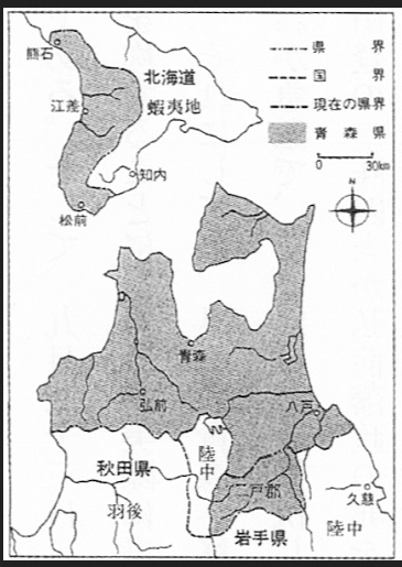
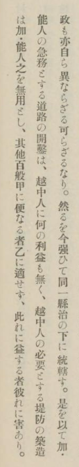
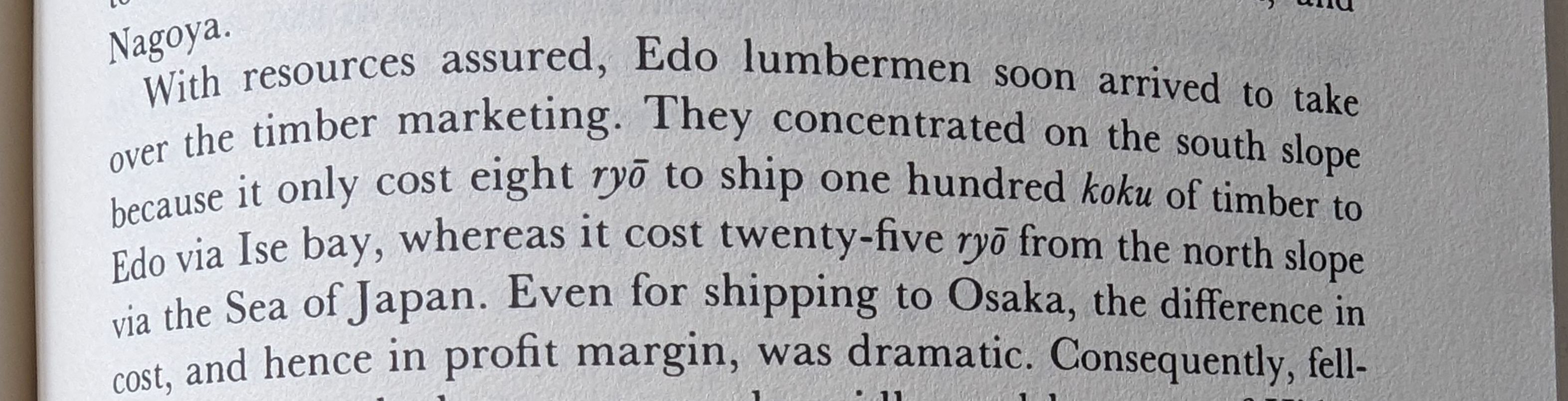
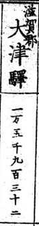
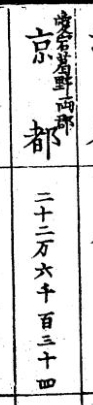
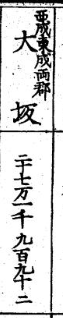

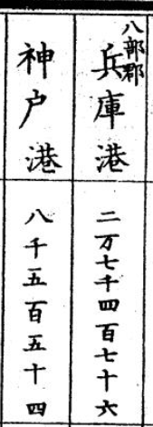


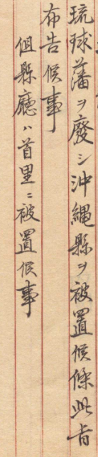
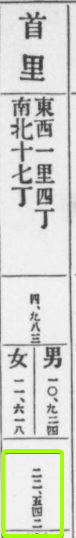